Skies are clearing in the Gulf Coast as now-Tropical Storm Ida moves inland, but the danger from the storm is far from over. All eyes are rightfully on Louisiana and Mississippi, where more than 1 million are without power and the impacts of Ida are still becoming clear. (Here are some suggestions to help those in need.)
But the storm’s lumbering pace inland means that other regions could also face consequences, including parts of Tennessee still reeling from the 1-in-1,000 year flash floods that hit last week. Ida will reach the region on Tuesday, and it could drop up to 6 inches (15 centimeters) of rainfall on the already waterlogged Middle Tennessee Valley.
Ida is currently crawling northward at about 9 mph (15 kph), with its center sitting over western Mississippi. The storm will hook northeast over the next 18 or so hours as it cuts across that state and portions of Alabama before reaching Tennessee. All areas in Ida’s path are under flash flood watches, with a smear of green across the National Weather Service’s forecast map stretching from Mississippi to New Jersey.
Any locations in Ida’s paths should heed those warnings. Drivers should not cross flooded roadways, and anyone living along waterways should keep an eye out for any signs of danger. But it’s particularly harrowing for residents in central Tennessee.
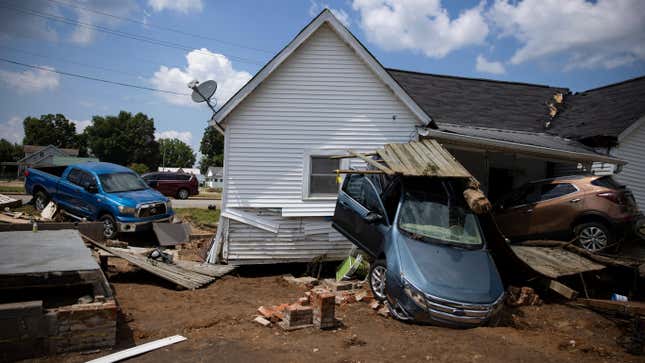
There, the heaviest 24-hour rainfall ever recorded in the state fell last weekend. More than 17 inches (43 centimeters) of rain fell on Humphreys County, unleashing deadly flash floods that killed at least 20. While Ida’s rainfall will be nowhere near that level, it will fall on soils that are still waterlogged with little ability to absorb water. The National Hurricane Center is calling for “considerable flash flooding” as a result, which could cause more damage in a region where emergency workers are still handing out hot meals for those without electricity or gas for cooking, and tarps for those without roofs or walls.
The highest odds of flooding in Tennessee are located a bit further east from the counties hit hardest last week, with Nashville in an area of moderate risk, according to the NHC forecast. Either way, it’s bad news for disaster managers in the state who are already stretched thin.
Parts of Appalachia could see up to 10 inches (25 centimeters) of rain and major cities from Philadelphia to Boston will also get soaked. Climate change has upped the odds of more heavy downpours because a hotter atmosphere can hold more water. This summer has made that all too clear even as the West dries out and burns, and showed why we urgently need to adapt to multiple hazards.